
Cochise County topographic map
Interactive map
Click on the map to display elevation.
About this map
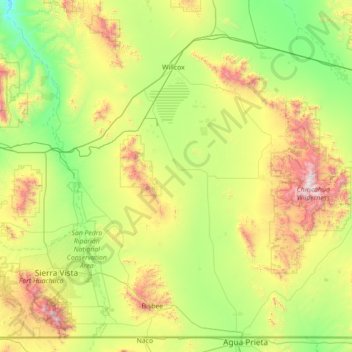
Name: Cochise County topographic map, elevation, terrain.
Location: Cochise County, Arizona, VS (31.33225 -110.45646 32.42769 -109.04762)
Average elevation: 1,410 m
Minimum elevation: 859 m
Maximum elevation: 2,959 m
Other topographic maps
Click on a map to view its topography, its elevation and its terrain.
Mormon Lake
VS > Arizona > Mormon Lake
Mormon Lake, Coconino County, Arizona, 86038, VS
Average elevation: 2,213 m
Saguaro National Park
Saguaro National Park, East Indigo Bush Place, Tucson, Pima County, Arizona, 85748, VS
Average elevation: 1,174 m
Oljato-Monument Valley
VS > Arizona > Oljato-Monument Valley
Oljato-Monument Valley, Navajo County, Arizona, VS
Average elevation: 1,620 m