
King Peak topographic map
Interactive map
Click on the map to display elevation.
About this map
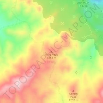
Name: King Peak topographic map, elevation, terrain.
Location: King Peak, Yavapai County, Arizona, VS (34.56525 -113.23053 34.56535 -113.23043)
Average elevation: 1,179 m
Minimum elevation: 995 m
Maximum elevation: 1,332 m
Other topographic maps
Click on a map to view its topography, its elevation and its terrain.
Mormon Lake
VS > Arizona > Mormon Lake
Mormon Lake, Coconino County, Arizona, 86038, VS
Average elevation: 2,213 m
Saguaro National Park
Saguaro National Park, East Indigo Bush Place, Tucson, Pima County, Arizona, 85748, VS
Average elevation: 1,174 m
Oljato-Monument Valley
VS > Arizona > Oljato-Monument Valley
Oljato-Monument Valley, Navajo County, Arizona, VS
Average elevation: 1,620 m