
Avenell Heights topographic map
Interactive map
Click on the map to display elevation.
About this map
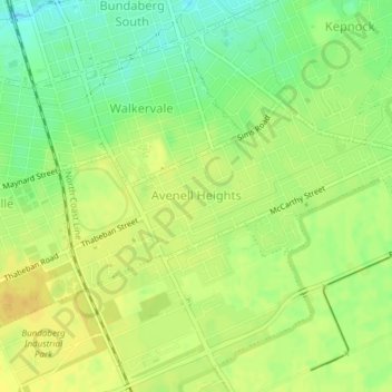
Name: Avenell Heights topographic map, elevation, terrain.
Average elevation: 23 m
Minimum elevation: 8 m
Maximum elevation: 33 m
Other topographic maps
Click on a map to view its topography, its elevation and its terrain.
Gavegan Street Park
Australia > Queensland > Bundaberg Region > Bundaberg
Gavegan Street Park, Bundaberg North, Bundaberg, Bundaberg Region, Queensland, 4670, Australia
Average elevation: 9 m