Geolocate

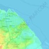
East Ravendale topographic map

Click on the map to display elevation.

About this map

Name: East Ravendale topographic map, elevation, terrain.

Location: East Ravendale, North East Lincolnshire, Greater Lincolnshire, England, United Kingdom (53.46712 -0.14798 53.48972 -0.11238)

Average elevation: 70 m

Minimum elevation: 25 m

Maximum elevation: 101 m

Other topographic maps

Click on a map to view its topography, its elevation and its terrain.
Gear up for your next adventure:

🍴Titanium Spork & Cutlery - Indestructible and feather-light eating utensils
🔥Ferrocerium Rod Fire Starters - Reliable fire lighting in wet or windy conditions without matches
🧺Fast-Dry Microfiber Towels - Large towels that pack down to the size of an orange
🦶Orthotic Hiking Insoles - Extra arch support for long-distance topographic treks
🧊Insulated Cooler Bags - Keep food fresh for day trips to remote geographic sites

As an Amazon Associate, this site earns from qualifying purchases at no extra cost to you.