Geolocate

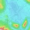
Marquartstein topographic map

Click on the map to display elevation.

About this map

Name: Marquartstein topographic map, elevation, terrain.

Location: Marquartstein, Marquartstein (VGem), Landkreis Traunstein, Bavaria, 83250, Germany (47.74339 12.40390 47.77158 12.49851)

Average elevation: 726 m

Minimum elevation: 524 m

Maximum elevation: 1,587 m

Other topographic maps

Click on a map to view its topography, its elevation and its terrain.

Tinning

Germany > Bavaria > Landkreis Traunstein

Average elevation: 519 m

Niederachen

Germany > Bavaria > Landkreis Traunstein > Eck

Average elevation: 768 m

Waginger See

Germany > Bavaria > Landkreis Traunstein > Waginger See > Fisching

Waginger See is a lake in the Alpine foothills, Bavaria, Germany. Geologically, it forms one single lake with the Tachinger See, with which it is connected through a narrow strait at Tettenhausen. The surface area of the Waginger See proper is 6.61 km2 (2.55 sq mi); combined with the Tachinger See it is 8.97…

Average elevation: 464 m
Gilling

Germany > Bavaria > Landkreis Traunstein > Petting

Average elevation: 477 m

Hochwies

Germany > Bavaria > Landkreis Traunstein > Trostberg

Average elevation: 528 m

Ollerding

Germany > Bavaria > Landkreis Traunstein > Tittmoning

Average elevation: 487 m

Burgham

Germany > Bavaria > Landkreis Traunstein > Seeon-Seebruck

Average elevation: 525 m

Schönberg

Germany > Bavaria > Landkreis Traunstein > Kienberg

Average elevation: 538 m

Gear up for your next adventure:

🧯Animal Deterrent Spray - Safety spray for wildlife
👄SPF Lip Balm - Prevent sun and wind-burnt lips on mountain ridges
🧊Insulated Cooler Bags - Keep food fresh for day trips to remote geographic sites
🧴Sunscreen SPF - Sun protection for outdoor activities
🧊Insulated Stainless Steel Flasks - Keep water cold for 24 hours in the heat or coffee hot in the cold

As an Amazon Associate, this site earns from qualifying purchases at no extra cost to you.