
Forsyth County topographic map
Interactive map
Click on the map to display elevation.
About this map
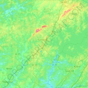
Name: Forsyth County topographic map, elevation, terrain.
Location: Forsyth County, Georgia, USA (34.05071 -84.25893 34.33517 -83.92553)
Average elevation: 344 m
Minimum elevation: 274 m
Maximum elevation: 577 m
Other topographic maps
Click on a map to view its topography, its elevation and its terrain.
Stone Mountain
Stone Mountain, DeKalb County, Georgia, 30087, USA
Average elevation: 299 m
Cameron Point
USA > Georgia > Cameron Point
Cameron Point, Hall County, Georgia, 30506:30534, USA
Average elevation: 339 m