Geolocate

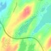
Ballyhack topographic map

Click on the map to display elevation.

About this map

Name: Ballyhack topographic map, elevation, terrain.

Location: Ballyhack, Avondale, Newfoundland, Newfoundland and Labrador, A0A 1Y0, Canada (47.42009 -53.22065 47.46009 -53.18065)

Average elevation: 36 m

Minimum elevation: -4 m

Maximum elevation: 132 m

Other topographic maps

Click on a map to view its topography, its elevation and its terrain.

Avondale

Canada > Newfoundland and Labrador > Avondale

Average elevation: 72 m

Nord Pond

Canada > Newfoundland and Labrador > Avondale

Average elevation: 113 m

Gear up for your next adventure:

🎒Tactical Waist Packs - Quick access to your compass, phone, and snacks while walking
📟Satellite Messengers - Two-way satellite communication to stay in touch beyond the cellular grid
🔪Camping Knives - Multi-purpose outdoor knives
🛌Sleeping Mats - Insulated mats for camping comfort
🕶️Polarized Sunglasses - UV protection sunglasses for outdoors

As an Amazon Associate, this site earns from qualifying purchases at no extra cost to you.