Geolocate

Avondale topographic map

Click on the map to display elevation.

About this map
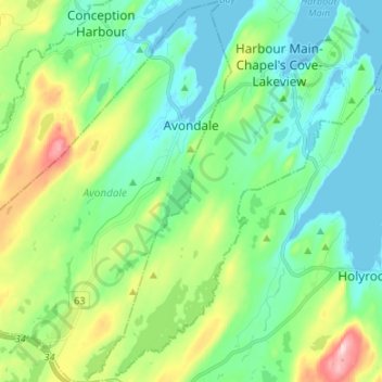
Name: Avondale topographic map, elevation, terrain.

Location: Avondale, Newfoundland, Newfoundland and Labrador, Canada (47.35899 -53.27292 47.44982 -53.17800)

Average elevation: 72 m

Minimum elevation: -3 m

Maximum elevation: 274 m

Other topographic maps

Click on a map to view its topography, its elevation and its terrain.

Ballyhack

Canada > Newfoundland and Labrador > Avondale

Average elevation: 36 m

Gear up for your next adventure:

🧢Outdoor Sun Hats - Sun protection hats for hiking
📟Satellite Messengers - Two-way satellite communication to stay in touch beyond the cellular grid
🧦Hiking Socks - Comfortable socks for long hikes
🔋Solar Power Banks - Charge your phone and GPS using the sun while deep in the bush
🔋Rechargeable Batteries - Eco-friendly power for high-drain GPS units and flashlights

As an Amazon Associate, this site earns from qualifying purchases at no extra cost to you.