Geolocate

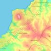
Mingoose topographic map

Click on the map to display elevation.

About this map

Name: Mingoose topographic map, elevation, terrain.

Location: Mingoose, St. Agnes, Mount Hawke, Cornwall, England, TR4 8BU, United Kingdom (50.27445 -5.22810 50.31445 -5.18810)

Average elevation: 102 m

Minimum elevation: 0 m

Maximum elevation: 187 m

Other topographic maps

Click on a map to view its topography, its elevation and its terrain.
St. Agnes

United Kingdom > England > Cornwall > Mount Hawke

Average elevation: 78 m

Gear up for your next adventure:

🧭Global Orienteering Compass - High-precision liquid-filled compasses for accurate map reading and navigation
🕶️Polarized Sunglasses - UV protection sunglasses for outdoors
🔥Windproof Plasma Lighters - USB rechargeable lighters that work in high-altitude winds
🚗Car Camping Gear - Equipment for vehicle camping
🧤Thermal Hiking Gloves - Keep your hands warm and functional during high-altitude winter treks

As an Amazon Associate, this site earns from qualifying purchases at no extra cost to you.