
Libertad topographic map
Interactive map
Click on the map to display elevation.
About this map
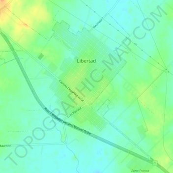
Name: Libertad topographic map, elevation, terrain.
Location: Libertad, San José, 80100, Uruguay (-34.65406 -56.64249 -34.61915 -56.59682)
Average elevation: 35 m
Minimum elevation: 22 m
Maximum elevation: 61 m
Other topographic maps
Click on a map to view its topography, its elevation and its terrain.
Delta del Tigre
Uruguay > San José > Ciudad del Plata
Delta del Tigre, Ciudad del Plata, San José, 80001, Uruguay
Average elevation: 3 m
Cañada Grande
Uruguay > San José > Cañada Grande
Cañada Grande, San José, 80000, Uruguay
Average elevation: 43 m
Puntas de Valdez
Uruguay > San José > Puntas de Valdez
Puntas de Valdez, San José, 80100, Uruguay
Average elevation: 45 m