
Salzburg topographic map
Interactive map
Click on the map to display elevation.
About this map
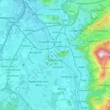
Name: Salzburg topographic map, elevation, terrain.
Location: Salzburg, 5020, Austria (47.75121 12.98565 47.85439 13.12753)
Average elevation: 498 m
Minimum elevation: 399 m
Maximum elevation: 1,290 m
Other topographic maps
Click on a map to view its topography, its elevation and its terrain.