
Swartbroek topographic map
Interactive map
Click on the map to display elevation.
About this map
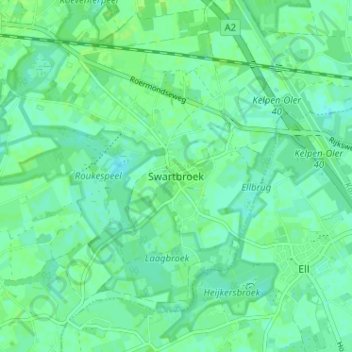
Name: Swartbroek topographic map, elevation, terrain.
Location: Swartbroek, Weert, Limburg, Nederland, 6005 PD, Nederland (51.21035 5.75169 51.25035 5.79169)
Average elevation: 31 m
Minimum elevation: 26 m
Maximum elevation: 34 m
Other topographic maps
Click on a map to view its topography, its elevation and its terrain.
Altweerterheide
Altweerterheide, Weert, Limburg, Nederland, 6006 TS, Nederland
Average elevation: 34 m