
Furano topographic map
Click on the map to display elevation.
About this map
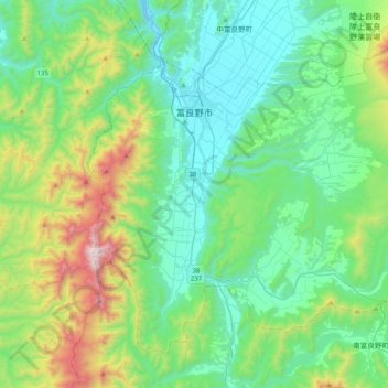
Name: Furano topographic map, elevation, terrain.
Location: Furano, Kamikawa Subprefecture, Hokkaido Prefecture, Japan (43.15669 142.27158 43.40137 142.67778)
Average elevation: 500 m
Minimum elevation: 150 m
Maximum elevation: 1,685 m
Other topographic maps
Click on a map to view its topography, its elevation and its terrain.