
Lamonriville topographic map
Interactive map
Click on the map to display elevation.
About this map
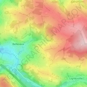
Name: Lamonriville topographic map, elevation, terrain.
Location: Lamonriville, Malmedy, Verviers, Liège, Wallonie, 4960, Belgique (50.37173 6.01147 50.41173 6.05147)
Average elevation: 427 m
Minimum elevation: 298 m
Maximum elevation: 551 m
Other topographic maps
Click on a map to view its topography, its elevation and its terrain.
Ligneuville
Belgique > Liège > Verviers > Malmedy
Ligneuville, Malmedy, Verviers, Liège, Wallonie, 4960, Belgique
Average elevation: 437 m