
Sandy Beach topographic map
Click on the map to display elevation.
About this map
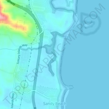
Name: Sandy Beach topographic map, elevation, terrain.
Average elevation: 11 m
Minimum elevation: -1 m
Maximum elevation: 137 m
New South Wales trails, hiking, mountain biking, running and outdoor activities
Other topographic maps
Click on a map to view its topography, its elevation and its terrain.
Sydney
Sydney's topography is characterized by a diverse landscape that seamlessly blends coastal features with inland plateaus. The city is divided into two primary regions: the relatively flat Cumberland Plain to the south and west of Sydney Harbour, and the elevated Hornsby Plateau to the north. The Cumberland…
Average elevation: 53 m
Orange
Orange is a city in the Central Tablelands region of New South Wales, Australia. It is 254 km (158 mi) west of the state capital, Sydney [206 km (128 mi) on a great circle], at an altitude of 862 metres (2,828 ft). Orange had an estimated urban population of 40,493 as of June 2018 making the city a significant…
Average elevation: 852 m
Mount Banks
Mount Banks, otherwise known as Mount King George, is a mountain within the Explorers Range of the Blue Mountains Range that is a spur off the Great Dividing Range, is located within the Blue Mountains National Park, approximately 100 kilometres (62 mi) west of Sydney in New South Wales, Australia. Mount Banks…
Average elevation: 745 m
Australian Alps
The Australian Alps are a mountain range in southeast Australia. It comprises an interim Australian bioregion, and is the highest mountain range in Australia. The range straddles the borders of eastern Victoria, southeastern New South Wales, and the Australian Capital Territory. It contains Australia's only…
Average elevation: 2,037 m
Byron Bay
Byron Bay, located in northeastern New South Wales, Australia, is characterized by diverse topography shaped by its geological history. The town is part of the erosion caldera of the ancient Tweed Volcano, which erupted approximately 23 million years ago, resulting in the rich volcanic soils that define the…
Average elevation: 7 m
Sydney
Phillip had been given no instructions for urban development, but in July 1788 submitted a plan for the new town at Sydney Cove. It included a wide central avenue, a permanent Government House, law courts, hospital and other public buildings, but no provision for warehouses, shops, or other commercial…
Average elevation: 32 m
Penrith
Australia > New South Wales > Sydney > Penrith
Penrith is a city in New South Wales, Australia, located in Greater Western Sydney, 55 kilometres (31 mi) west of the Sydney central business district on the banks of the Nepean River, on the outskirts of the Cumberland Plain. Its elevation is 32 metres (105 ft).
Average elevation: 34 m
Mount Victoria
Mount Victoria (postcode: 2786) is a small township in the Blue Mountains of New South Wales, Australia. Mount Victoria is geographically the western most village and suburb of Greater Sydney on the great western highway in the City of Blue Mountains, located about 120 kilometres (75 mi) west-northwest by road…
Average elevation: 901 m
Goulburn
Owing to its elevation, Goulburn has an oceanic climate (Cfb) with warm summers and cool winters; with a high diurnal range. Its climate is variable much of the year, though generally dry with maximum temperatures ranging from 11.8 °C (53.2 °F) in July to 28.3 °C (82.9 °F) in January. Rainfall is…
Average elevation: 666 m
Leura
Leura's elevation of 985 metres (3,232 ft) AHD leads to occasional snowfall in winter and a climate that reflects all four seasons distinctly.
Average elevation: 880 m
Blackheath
Blackheath (postcode: 2785) is an Australian town located near the highest point of the Blue Mountains, between Katoomba and Mount Victoria in New South Wales. The town's altitude is about 1,065 metres (3,494 ft) AHD and it is located about 120 kilometres (75 mi) west north-west of Sydney, 11 kilometres…
Average elevation: 893 m