
Thank you for supporting this site ❤️
Make a donation
Make a donation
Gear up for your next adventure:
As an Amazon Associate, this site earns from qualifying purchases at no extra cost to you.
Chogwa-ri topographic map
Click on the map to display elevation.
Thank you for supporting this site ❤️
Make a donation
Make a donation
Gear up for your next adventure:
As an Amazon Associate, this site earns from qualifying purchases at no extra cost to you.
About this map
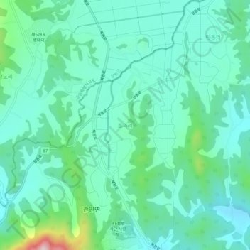
Name: Chogwa-ri topographic map, elevation, terrain.
Location: Chogwa-ri, Pocheon-si, 11101, South Korea (38.13051 127.22661 38.17051 127.26661)
Average elevation: 198 m
Minimum elevation: 128 m
Maximum elevation: 471 m
Thank you for supporting this site ❤️
Make a donation
Make a donation
Gear up for your next adventure:
As an Amazon Associate, this site earns from qualifying purchases at no extra cost to you.