
パッタヤー topographic map
Interactive map
Click on the map to display elevation.
About this map
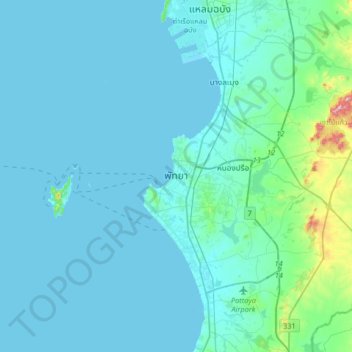
Name: パッタヤー topographic map, elevation, terrain.
Location: パッタヤー, หนองปลาไหล, チョンブリー県, 20210, タイ王国 (12.77667 100.72646 13.09667 101.04646)
Average elevation: 28 m
Minimum elevation: -1 m
Maximum elevation: 337 m
Other topographic maps
Click on a map to view its topography, its elevation and its terrain.