
Kingham topographic map
Interactive map
Click on the map to display elevation.
About this map
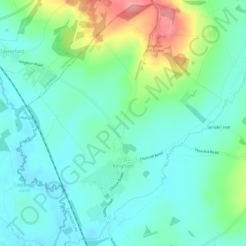
Name: Kingham topographic map, elevation, terrain.
Average elevation: 130 m
Minimum elevation: 104 m
Maximum elevation: 203 m
Other topographic maps
Click on a map to view its topography, its elevation and its terrain.
Chadlington
United Kingdom > England > Oxfordshire > West Oxfordshire > Charlbury
Chadlington, Charlbury, West Oxfordshire, Oxfordshire, England, United Kingdom
Average elevation: 161 m
Kelmscott
United Kingdom > England > Oxfordshire > West Oxfordshire
Kelmscott, West Oxfordshire, Oxfordshire, England, United Kingdom
Average elevation: 73 m
Witney
United Kingdom > England > Oxfordshire > West Oxfordshire
Witney, West Oxfordshire, Oxfordshire, England, United Kingdom
Average elevation: 92 m
Hailey
United Kingdom > England > Oxfordshire > West Oxfordshire
Hailey, West Oxfordshire, Oxfordshire, England, United Kingdom
Average elevation: 113 m
Lyneham
United Kingdom > England > Oxfordshire > West Oxfordshire
Lyneham, West Oxfordshire, Oxfordshire, England, United Kingdom
Average elevation: 130 m
Chipping Norton
United Kingdom > England > Oxfordshire > West Oxfordshire > Chipping Norton
Chipping Norton, West Oxfordshire, Oxfordshire, England, United Kingdom
Average elevation: 194 m