Geolocate

Hailey topographic map

Click on the map to display elevation.

About this map

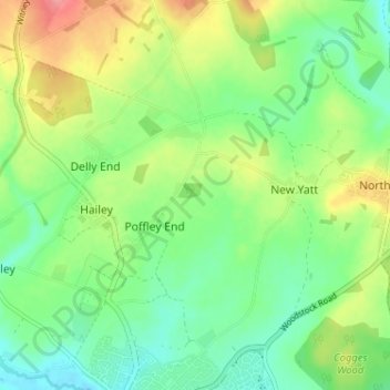
Name: Hailey topographic map, elevation, terrain.

Location: Hailey, West Oxfordshire, Oxfordshire, England, United Kingdom (51.79384 -1.50819 51.83361 -1.45280)

Average elevation: 113 m

Minimum elevation: 81 m

Maximum elevation: 166 m

Other topographic maps

Click on a map to view its topography, its elevation and its terrain.

Gear up for your next adventure:

👄SPF Lip Balm - Prevent sun and wind-burnt lips on mountain ridges
🦶Orthotic Hiking Insoles - Extra arch support for long-distance topographic treks
🎒Daypacks - Compact backpacks for short hikes
🗺️Topographic Maps - Detailed maps for hiking and navigation
🎒Hiking Backpacks - Backpacks designed for hiking and trekking

As an Amazon Associate, this site earns from qualifying purchases at no extra cost to you.