
Tamura topographic map
Click on the map to display elevation.
About this map
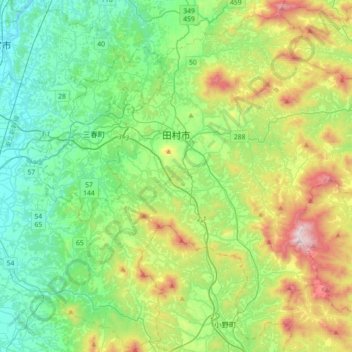
Name: Tamura topographic map, elevation, terrain.
Location: Tamura, Fukushima Prefecture, Japan (37.27460 140.50414 37.53808 140.86196)
Average elevation: 478 m
Minimum elevation: 197 m
Maximum elevation: 1,175 m
Other topographic maps
Click on a map to view its topography, its elevation and its terrain.