Geolocate

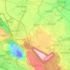
Glesch topographic map

Click on the map to display elevation.

About this map

Name: Glesch topographic map, elevation, terrain.

Location: Glesch, Bergheim, Rhein-Erft-Kreis, North Rhine-Westphalia, 50126, Germany (50.95243 6.57307 50.99243 6.61307)

Average elevation: 68 m

Minimum elevation: 29 m

Maximum elevation: 108 m

Other topographic maps

Click on a map to view its topography, its elevation and its terrain.

Gear up for your next adventure:

🦶Orthotic Hiking Insoles - Extra arch support for long-distance topographic treks
🥤Outdoor Water Bottles - Reusable bottles for outdoor activities
⛺Lightweight Tents - Compact tents for backpacking
🔋Rechargeable Batteries - Eco-friendly power for high-drain GPS units and flashlights
🕶️Polarized Outdoor Sunglasses - Reduce glare from rocks and water for better visual navigation

As an Amazon Associate, this site earns from qualifying purchases at no extra cost to you.