Geolocate

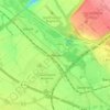
50129 topographic map

Click on the map to display elevation.

About this map

Name: 50129 topographic map, elevation, terrain.

Location: 50129, Bergheim, Rhein-Erft-Kreis, North Rhine-Westphalia, Germany (50.93580 6.63530 51.02190 6.76705)

Average elevation: 91 m

Minimum elevation: -85 m

Maximum elevation: 207 m

Other topographic maps

Click on a map to view its topography, its elevation and its terrain.

Gear up for your next adventure:

🥤Hydration Packs - Hydration systems for hiking
🔋Solar Power Banks - Solar chargers for outdoors
🥶Thermal Beanies - Warm hats for cold hikes
🧢Wide Brim Sun Hats - Maximum coverage for the face and neck while out in the open
🕶️Polarized Outdoor Sunglasses - Reduce glare from rocks and water for better visual navigation

As an Amazon Associate, this site earns from qualifying purchases at no extra cost to you.