
Exposition Park topographic map
Click on the map to display elevation.
About this map
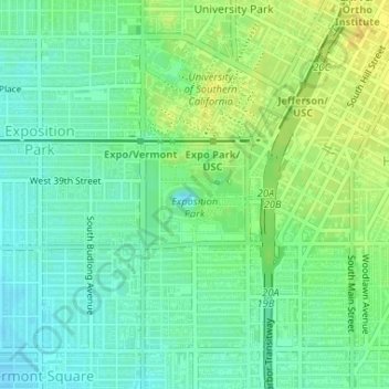
Name: Exposition Park topographic map, elevation, terrain.
Average elevation: 55 m
Minimum elevation: 45 m
Maximum elevation: 68 m
Other topographic maps
Click on a map to view its topography, its elevation and its terrain.
San Fernando Valley
United States > California > Los Angeles County > Los Angeles
Average elevation: 496 m
Valley Village Neighborhood Council District
United States > California > Los Angeles County > Los Angeles
Average elevation: 199 m
Studio City Neighborhood Council District
United States > California > Los Angeles County > Los Angeles
Average elevation: 255 m
Canoga Park Neighborhood Council District
United States > California > Los Angeles County > Los Angeles
Average elevation: 255 m
Universal City Overlook
United States > California > Los Angeles County > Los Angeles
Average elevation: 278 m
Porter Ranch Neighborhood Council District
United States > California > Los Angeles County > Los Angeles
Average elevation: 460 m
Van Nuys Neighborhood Council District
United States > California > Los Angeles County > Los Angeles
Average elevation: 224 m
Arleta Neighborhood Council District
United States > California > Los Angeles County > Los Angeles
Average elevation: 274 m
Winnetka Neighborhood Council District
United States > California > Los Angeles County > Los Angeles
Average elevation: 244 m
Sherman Oaks Neighborhood Council District
United States > California > Los Angeles County > Los Angeles
Average elevation: 257 m
Chatsworth Neighborhood Council District
United States > California > Los Angeles County > Los Angeles
Average elevation: 360 m
North Hollywood Neighborhood Council District
United States > California > Los Angeles County > Los Angeles
Average elevation: 196 m
Encino Neighborhood Council District
United States > California > Los Angeles County > Los Angeles
Average elevation: 288 m
Pacoima Neighborhood Council
United States > California > Los Angeles County > Los Angeles
Average elevation: 312 m
San Fernando Valley
United States > California > Los Angeles County > Los Angeles
Average elevation: 496 m
Pacific Palisades
United States > California > Los Angeles County > Los Angeles
Pacific Palisades was formally founded in 1921 by a Methodist organization, and in the years that followed became a refuge for Jewish artists and intellectuals fleeing the Holocaust. The Palisades would later be sought after by celebrities and other high-profile individuals seeking privacy. It is known for its…
Average elevation: 196 m
Lake Balboa Neighborhood Council District
United States > California > Los Angeles County > Los Angeles
Average elevation: 230 m
South Los Angeles
United States > California > Los Angeles County > Los Angeles
Average elevation: 421 m
Chatsworth Neighborhood Council District
United States > California > Los Angeles County > Los Angeles
Average elevation: 360 m
Sherman Oaks Neighborhood Council District
United States > California > Los Angeles County > Los Angeles
Average elevation: 257 m
Valley Village Neighborhood Council District
United States > California > Los Angeles County > Los Angeles
Average elevation: 199 m
Van Nuys Neighborhood Council District
United States > California > Los Angeles County > Los Angeles
Average elevation: 224 m
Los Angeles City Council District 11
United States > California > Los Angeles County > Los Angeles
Average elevation: 141 m
Aliso Canyon Park
United States > California > Los Angeles County > Los Angeles
Average elevation: 420 m
Chatsworth Neighborhood Council District
United States > California > Los Angeles County > Los Angeles
Average elevation: 361 m
Chatsworth Neighborhood Council District
United States > California > Los Angeles County > Los Angeles
Average elevation: 360 m
San Fernando Valley
United States > California > Los Angeles County > Los Angeles
Average elevation: 496 m
Hollywood Hills
United States > California > Los Angeles County > Los Angeles
Average elevation: 242 m
North Hollywood Neighborhood Council District
United States > California > Los Angeles County > Los Angeles
Average elevation: 196 m
Chatsworth Neighborhood Council District
United States > California > Los Angeles County > Los Angeles
Average elevation: 360 m
Los Angeles City Council District 7
United States > California > Los Angeles County > Los Angeles
Average elevation: 512 m