
Tariat topographic map
Interactive map
Click on the map to display elevation.
About this map
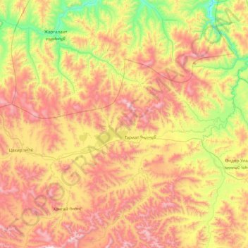
Name: Tariat topographic map, elevation, terrain.
Location: Tariat, Archangai, Mongolei (47.91318 99.04046 48.50870 100.60370)
Average elevation: 2,174 m
Minimum elevation: 1,440 m
Maximum elevation: 3,297 m
Other topographic maps
Click on a map to view its topography, its elevation and its terrain.