
Iowa County topographic map
Interactive map
Click on the map to display elevation.
About this map
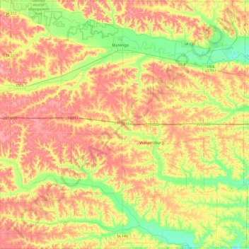
Name: Iowa County topographic map, elevation, terrain.
Location: Iowa County, Iowa, Verenigde Staten van Amerika (41.50959 -92.30165 41.86295 -91.82700)
Average elevation: 249 m
Minimum elevation: 206 m
Maximum elevation: 288 m
Other topographic maps
Click on a map to view its topography, its elevation and its terrain.
Marathon
Verenigde Staten van Amerika > Iowa > Marathon
Marathon, Buena Vista County, Iowa, Verenigde Staten van Amerika
Average elevation: 417 m
Cerro Gordo County
Verenigde Staten van Amerika > Iowa
Cerro Gordo County, Iowa, Verenigde Staten van Amerika
Average elevation: 358 m