
Cerro Gordo County topographic map
Interactive map
Click on the map to display elevation.
About this map
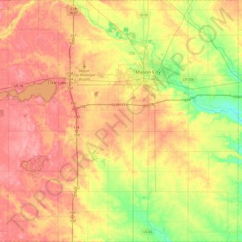
Name: Cerro Gordo County topographic map, elevation, terrain.
Location: Cerro Gordo County, Iowa, Verenigde Staten van Amerika (42.90753 -93.49862 43.25763 -93.02341)
Average elevation: 358 m
Minimum elevation: 311 m
Maximum elevation: 397 m
Other topographic maps
Click on a map to view its topography, its elevation and its terrain.
Marathon
Verenigde Staten van Amerika > Iowa > Marathon
Marathon, Buena Vista County, Iowa, Verenigde Staten van Amerika
Average elevation: 417 m
Iowa County
Verenigde Staten van Amerika > Iowa
Iowa County, Iowa, Verenigde Staten van Amerika
Average elevation: 249 m