
Fontão topographic map
Interactive map
Click on the map to display elevation.
About this map
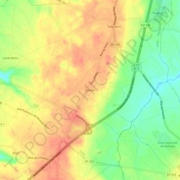
Name: Fontão topographic map, elevation, terrain.
Location: Fontão, Sosa, Vagos, Aveiro, 3840-341, Portugal (40.52700 -8.65161 40.56700 -8.61161)
Average elevation: 48 m
Minimum elevation: 15 m
Maximum elevation: 72 m
Other topographic maps
Click on a map to view its topography, its elevation and its terrain.