
Salgueiro topographic map
Interactive map
Click on the map to display elevation.
About this map
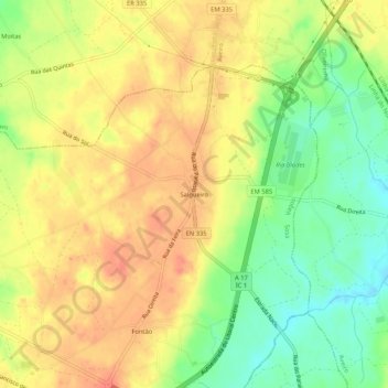
Name: Salgueiro topographic map, elevation, terrain.
Location: Salgueiro, Sosa, Vagos, Aveiro, 3810-265, Portugal (40.54113 -8.64452 40.58113 -8.60452)
Average elevation: 47 m
Minimum elevation: 14 m
Maximum elevation: 72 m
Other topographic maps
Click on a map to view its topography, its elevation and its terrain.