
Town of Grand Chute topographic map
Interactive map
Click on the map to display elevation.
About this map
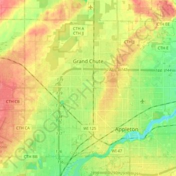
Name: Town of Grand Chute topographic map, elevation, terrain.
Average elevation: 245 m
Minimum elevation: 215 m
Maximum elevation: 275 m
Other topographic maps
Click on a map to view its topography, its elevation and its terrain.
Appleton
United States > Wisconsin > Outagamie County > Appleton
Appleton, Outagamie County, Wisconsin, United States
Average elevation: 240 m
Kimberly
United States > Wisconsin > Outagamie County
Kimberly, Outagamie County, Wisconsin, 54136, United States
Average elevation: 225 m