
Hamersley Range topographic map
Click on the map to display elevation.
About this map
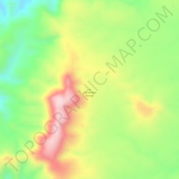
Name: Hamersley Range topographic map, elevation, terrain.
Location: Hamersley Range, Western Australia, Australia (-21.87293 116.79331 -21.87283 116.79341)
Average elevation: 511 m
Minimum elevation: 366 m
Maximum elevation: 657 m
Western Australia trails, hiking, mountain biking, running and outdoor activities
Other topographic maps
Click on a map to view its topography, its elevation and its terrain.
Laverton
Laverton, originally known as British Flag, is a town in the Goldfields region of Western Australia, and the centre of administration for the Shire of Laverton. The town of Laverton is located at the western edge of the Great Victoria Desert, 957 kilometres (595 mi) north-northeast of the state capital, Perth,…
Average elevation: 447 m
Exmouth
In 2009, an emergency landing of the flight Qantas 72 was made at the nearby Learmonth Airport / RAAF Base Learmonth. The A330 had an incident involving the ADIRU which confused AoA (Angle of Attack) data with altitude data, making the plane think it was in a 16° pitch up when it was flying level. So the…
Average elevation: 27 m
Henley Brook
Henley Brook is situated on the flood plains of the Swan River, with regularly occurring seasonal floods. Two ephemeral streams from the river - Henley Brook and St. Leonard's Creek - traverse the suburb. Henley Brook is in the north-east near Brockman Street, while St Leonards Creek traverses the centre of…
Average elevation: 28 m