
Lwambogo topographic map
Interactive map
Click on the map to display elevation.
About this map
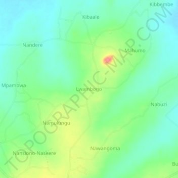
Name: Lwambogo topographic map, elevation, terrain.
Location: Lwambogo, Kaliro, Eastern Region, Uganda (1.10430 33.53732 1.14430 33.57732)
Average elevation: 1,061 m
Minimum elevation: 1,038 m
Maximum elevation: 1,109 m
Other topographic maps
Click on a map to view its topography, its elevation and its terrain.