
Celendín topographic map
Interactive map
Click on the map to display elevation.
About this map
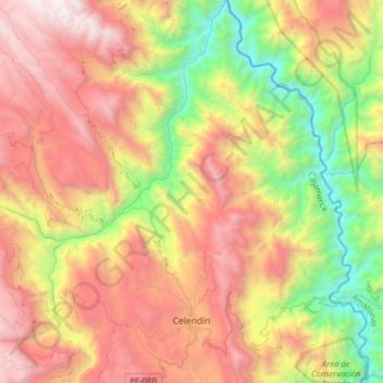
Name: Celendín topographic map, elevation, terrain.
Location: Celendín, Provincia de Celendín, Cajamarca, Perú (-6.91669 -78.21495 -6.60272 -78.01406)
Average elevation: 2,269 m
Minimum elevation: 762 m
Maximum elevation: 3,973 m
Other topographic maps
Click on a map to view its topography, its elevation and its terrain.