Geolocate

Childers topographic map

Click on the map to display elevation.

About this map

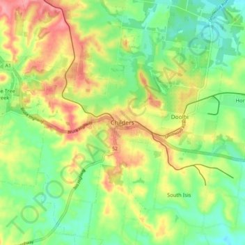
Name: Childers topographic map, elevation, terrain.

Location: Childers, Bundaberg Region, Queensland, 4660, Australia (-25.27454 152.23682 -25.19454 152.31682)

Average elevation: 79 m

Minimum elevation: 35 m

Maximum elevation: 138 m

Queensland trails, hiking, mountain biking, running and outdoor activities

Gear up for your next adventure:

👕UPF 50+ Sun Shirts - Essential protection against the harsh Australian sun during field work
🛰️Handheld GPS Units - Rugged GPS devices for tracking coordinates and elevation in the Australian bush
🧴Sunscreen SPF - Sun protection for outdoor activities
Altimeter Barometer Watches - Outdoor watches with built-in sensors to track altitude changes and weather shifts
🛠️Outdoor Repair Kits - Gear repair kits

As an Amazon Associate, this site earns from qualifying purchases at no extra cost to you.