Geolocate

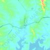
Winya topographic map

Click on the map to display elevation.

About this map

Name: Winya topographic map, elevation, terrain.

Location: Winya, Kilcoy, Somerset Regional, Queensland, 4515, Australia (-27.00476 152.55407 -26.91279 152.61090)

Average elevation: 126 m

Minimum elevation: 94 m

Maximum elevation: 467 m

Queensland trails, hiking, mountain biking, running and outdoor activities

Other topographic maps

Click on a map to view its topography, its elevation and its terrain.
Kilcoy

Australia > Queensland > Kilcoy

Average elevation: 125 m

Winya

Australia > Queensland > Kilcoy > Winya

Average elevation: 126 m

Gear up for your next adventure:

🕯️Emergency Whistles - Safety whistles for hiking
🥾Hiking Boots - Durable hiking boots for trails and rough terrain
🖼️Scratch-off Australia Map - Track the regions and peaks you have explored geographically
📕Hiking Guide Books - Guides for hiking trails
🧭Global Orienteering Compass - High-precision liquid-filled compasses for accurate map reading and navigation

As an Amazon Associate, this site earns from qualifying purchases at no extra cost to you.