
Melo topographic map
Interactive map
Click on the map to display elevation.
About this map
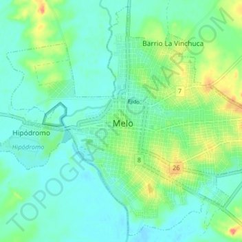
Name: Melo topographic map, elevation, terrain.
Location: Melo, Cerro Largo, 37000, Uruguay (-32.39352 -54.20102 -32.34158 -54.13598)
Average elevation: 108 m
Minimum elevation: 93 m
Maximum elevation: 149 m
Other topographic maps
Click on a map to view its topography, its elevation and its terrain.
Hipódromo
Uruguay > Cerro Largo > Hipódromo
Hipódromo, Cerro Largo, 37000, Uruguay
Average elevation: 113 m
Fraile Muerto
Uruguay > Cerro Largo > Fraile Muerto
Fraile Muerto, Cerro Largo, 37005, Uruguay
Average elevation: 136 m
Quebracho
Uruguay > Cerro Largo > Quebracho
Quebracho, Cerro Largo, 37004, Uruguay
Average elevation: 148 m