Geolocate

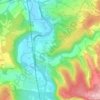
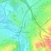
Abinger Hammer topographic map

Click on the map to display elevation.

About this map

Name: Abinger Hammer topographic map, elevation, terrain.

Location: Abinger Hammer, Mole Valley, Surrey, England, RH5 6SE, United Kingdom (51.19695 -0.45318 51.23695 -0.41318)

Average elevation: 139 m

Minimum elevation: 74 m

Maximum elevation: 233 m

Other topographic maps

Click on a map to view its topography, its elevation and its terrain.
Leatherhead

United Kingdom > England > Surrey > Mole Valley

Average elevation: 54 m

Dorking

United Kingdom > England > Surrey > Mole Valley

Average elevation: 80 m

Capel

United Kingdom > England > Surrey > Mole Valley > Capel

Average elevation: 102 m

Charlwood

United Kingdom > England > Surrey > Mole Valley > Charlwood

Average elevation: 72 m

Betchworth

United Kingdom > England > Surrey > Mole Valley

Average elevation: 81 m

Mickleham

United Kingdom > England > Surrey > Mole Valley > Mickleham

Average elevation: 103 m

Newdigate

United Kingdom > England > Surrey > Mole Valley

Average elevation: 86 m

Headley

United Kingdom > England > Surrey > Mole Valley

Average elevation: 146 m

Ockley

United Kingdom > England > Surrey > Mole Valley > Ockley

Average elevation: 90 m

Brockham

United Kingdom > England > Surrey > Mole Valley

Average elevation: 73 m

Headley Heath

United Kingdom > England > Surrey > Mole Valley > Headley

Average elevation: 163 m

Leigh

United Kingdom > England > Surrey > Mole Valley > Leigh

Average elevation: 63 m

Wotton

United Kingdom > England > Surrey > Mole Valley

Average elevation: 135 m

Ranmore Common

United Kingdom > England > Surrey > Mole Valley > Westcott

Average elevation: 138 m

Wallis Wood

United Kingdom > England > Surrey > Mole Valley > Walliswood

Average elevation: 76 m

Mickleham

United Kingdom > England > Surrey > Mole Valley > Mickleham

Average elevation: 103 m

Dorking

United Kingdom > England > Surrey > Mole Valley

Average elevation: 80 m

Ranmore Common

United Kingdom > England > Surrey > Mole Valley

Average elevation: 138 m

Gear up for your next adventure:

🦶Orthotic Hiking Insoles - Extra arch support for long-distance topographic treks
🔦Powerful LED Headlamps - Hands-free lighting for night navigation and setting up camp after dark
🧥Packable Rain Jackets - Breathable waterproof layers for unpredictable mountain weather
🔌Fast Charging Adapters - Quickly top up all your gear before heading back into the field
🔑Heavy Duty Carabiners - Secure gear to the outside of your pack for easy access

As an Amazon Associate, this site earns from qualifying purchases at no extra cost to you.