
Baie des Tourelles topographic map
Interactive map
Click on the map to display elevation.
About this map
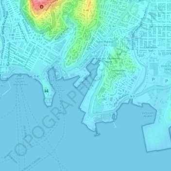
Name: Baie des Tourelles topographic map, elevation, terrain.
Average elevation: 11 m
Minimum elevation: -4 m
Maximum elevation: 121 m
Other topographic maps
Click on a map to view its topography, its elevation and its terrain.
Plage La Française
France > Martinique > Fort-de-France
Plage La Française, Fort-de-France, Martinique, France
Average elevation: 18 m