Geolocate

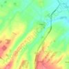
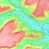
Kingsdown topographic map

Click on the map to display elevation.

About this map

Name: Kingsdown topographic map, elevation, terrain.

Location: Kingsdown, Dover, Kent, England, CT14 8AH, United Kingdom (51.16684 1.38274 51.20684 1.42274)

Average elevation: 20 m

Minimum elevation: 0 m

Maximum elevation: 84 m

Other topographic maps

Click on a map to view its topography, its elevation and its terrain.
Sandwich

United Kingdom > England > Kent > Dover > Stone Cross

Average elevation: 5 m

Tilmanstone

United Kingdom > England > Kent > Dover

Average elevation: 69 m

Eastry

United Kingdom > England > Kent > Dover > Eastry

Average elevation: 32 m

Whitfield

United Kingdom > England > Kent > Dover

Average elevation: 101 m

Temple Ewell

United Kingdom > England > Kent > Dover

Average elevation: 96 m

Alkham

United Kingdom > England > Kent > Dover

Average elevation: 119 m

Nonington

United Kingdom > England > Kent > Dover

Average elevation: 68 m

Wingham

United Kingdom > England > Kent > Dover

Average elevation: 22 m

Whitfield

United Kingdom > England > Kent > Dover > Whitfield

Average elevation: 101 m

River

United Kingdom > England > Kent > Dover

Average elevation: 80 m

Sandwich

United Kingdom > England > Kent > Dover

Average elevation: 5 m

Deal

United Kingdom > England > Kent > Dover

Average elevation: 6 m

River

United Kingdom > England > Kent > Dover > River

Average elevation: 80 m

Gear up for your next adventure:

🔑Heavy Duty Carabiners - Secure gear to the outside of your pack for easy access
🔪Multitools - Compact tools for outdoor use
🕯️Emergency Whistles - Safety whistles for hiking
🎒40L Day Hiking Backpacks - Comfortable packs with hydration support for long days exploring topographic peaks
🪢Paracord - Multi-purpose survival cord

As an Amazon Associate, this site earns from qualifying purchases at no extra cost to you.