
교하동 topographic map
Interactive map
Click on the map to display elevation.
About this map
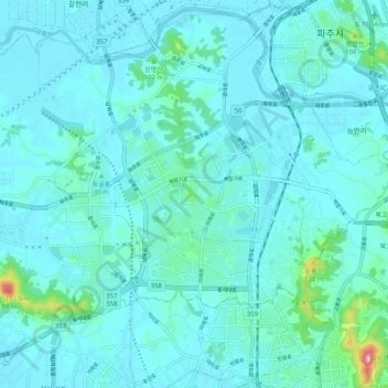
Name: 교하동 topographic map, elevation, terrain.
Location: 교하동, Paju, Gyeonggi, Corée du Sud (37.68863 126.67407 37.76440 126.77546)
Average elevation: 24 m
Minimum elevation: 2 m
Maximum elevation: 208 m
Other topographic maps
Click on a map to view its topography, its elevation and its terrain.