Geolocate

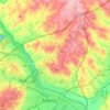
Barefoot topographic map

Click on the map to display elevation.

About this map

Name: Barefoot topographic map, elevation, terrain.

Location: Barefoot, Aiken County, South Carolina, United States (33.68348 -81.49733 33.72348 -81.45733)

Average elevation: 153 m

Minimum elevation: 126 m

Maximum elevation: 174 m

Other topographic maps

Click on a map to view its topography, its elevation and its terrain.

Aiken

United States > South Carolina > Aiken County

Average elevation: 134 m

Wagener

United States > South Carolina > Aiken County

Average elevation: 137 m

Salley

United States > South Carolina > Aiken County

Average elevation: 103 m

Windsor

United States > South Carolina > Aiken County

Average elevation: 117 m

Jackson

United States > South Carolina > Aiken County

Average elevation: 72 m

Aiken

United States > South Carolina > Aiken County

Average elevation: 134 m

Aiken

United States > South Carolina > Aiken County

Average elevation: 134 m

Gear up for your next adventure:

🎧Bluetooth Outdoor Earbuds - Listen to navigation cues or podcasts during long solo treks
🕶️Polarized Outdoor Sunglasses - Reduce glare from rocks and water for better visual navigation
📣High-Decibel Survival Whistles - Signaling tool for rescue that carries much further than a human voice
⌚Altimeter Barometer Watches - Outdoor watches with built-in sensors to track altitude changes and weather shifts
🎨Portable Watercolor Kits - Paint the landscapes and topographic views you discover

As an Amazon Associate, this site earns from qualifying purchases at no extra cost to you.