Geolocate

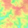
North Augusta topographic map

Click on the map to display elevation.

About this map
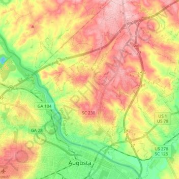
Name: North Augusta topographic map, elevation, terrain.

Location: North Augusta, Aiken County, South Carolina, 29841, United States (33.46005 -82.01102 33.58171 -81.89595)

Average elevation: 91 m

Minimum elevation: 8 m

Maximum elevation: 169 m

Other topographic maps

Click on a map to view its topography, its elevation and its terrain.

Langley

United States > South Carolina > Aiken County

Average elevation: 82 m

Camp Long

United States > South Carolina > Aiken County

Average elevation: 115 m

Eureka

United States > South Carolina > Aiken County

Average elevation: 150 m

Springdale

United States > South Carolina > Aiken County

Average elevation: 131 m

Barefoot

United States > South Carolina > Aiken County

Average elevation: 153 m

Oakwood

United States > South Carolina > Aiken County

Average elevation: 124 m

Bath

United States > South Carolina > Aiken County > Burnettown

Average elevation: 69 m

Seivern

United States > South Carolina > Aiken County

Average elevation: 114 m

Aiken

United States > South Carolina > Aiken County > Aiken > Aiken

Average elevation: 143 m

Langley

United States > South Carolina > Aiken County

Average elevation: 82 m

Gear up for your next adventure:

🌿Flora and Fauna Field Guides - Identify the plants and animals you encounter on your route
🕯️Emergency Whistles - Safety whistles for hiking
🔦Powerful LED Headlamps - Hands-free lighting for night navigation and setting up camp after dark
🧊Insulated Stainless Steel Flasks - Keep water cold for 24 hours in the heat or coffee hot in the cold
🧭Military Style Lensatic Compass - Durable sighting compasses for advanced land navigation and surveying

As an Amazon Associate, this site earns from qualifying purchases at no extra cost to you.