
Kito-kiganda topographic map
Interactive map
Click on the map to display elevation.
About this map
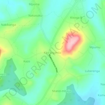
Name: Kito-kiganda topographic map, elevation, terrain.
Location: Kito-kiganda, Mukono, Central Region, Uganda (0.21152 32.78699 0.25152 32.82699)
Average elevation: 1,203 m
Minimum elevation: 1,151 m
Maximum elevation: 1,327 m
Other topographic maps
Click on a map to view its topography, its elevation and its terrain.