
Bulika topographic map
Interactive map
Click on the map to display elevation.
About this map
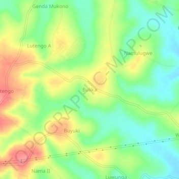
Name: Bulika topographic map, elevation, terrain.
Location: Bulika, Mukono, Central Region, Uganda (0.39955 32.79072 0.43955 32.83072)
Average elevation: 1,134 m
Minimum elevation: 1,097 m
Maximum elevation: 1,180 m
Other topographic maps
Click on a map to view its topography, its elevation and its terrain.