Geolocate

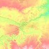
Vaughn topographic map

Click on the map to display elevation.

About this map

Name: Vaughn topographic map, elevation, terrain.

Location: Vaughn, Cascade County, Montana, 59487, United States (47.53947 -111.59707 47.56851 -111.52554)

Average elevation: 1,034 m

Minimum elevation: 1,016 m

Maximum elevation: 1,117 m

Other topographic maps

Click on a map to view its topography, its elevation and its terrain.

Stockett

United States > Montana > Cascade County

Average elevation: 1,163 m

Great Falls

United States > Montana > Cascade County > Great Falls

Average elevation: 1,073 m

Ryan Dam

United States > Montana > Cascade County

Average elevation: 981 m

Eden Bridge

United States > Montana > Cascade County

Average elevation: 1,110 m

Hardy

United States > Montana > Cascade County

Average elevation: 1,128 m

Roe River

United States > Montana > Cascade County

Average elevation: 1,024 m

Gear up for your next adventure:

🔪Outdoor Multi-tools - Versatile tools for gear repair and survival tasks in the wilderness
🏫Topographic World Globes - 3D physical relief globes to understand global geography
🧤Thermal Hiking Gloves - Keep your hands warm and functional during high-altitude winter treks
🧰Survival Kits - Essential survival gear
🎨Portable Watercolor Kits - Paint the landscapes and topographic views you discover

As an Amazon Associate, this site earns from qualifying purchases at no extra cost to you.