Geolocate

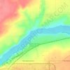
Stockett topographic map

Click on the map to display elevation.

About this map

Name: Stockett topographic map, elevation, terrain.

Location: Stockett, Cascade County, Montana, 59480, United States (47.33555 -111.18674 47.37555 -111.14674)

Average elevation: 1,163 m

Minimum elevation: 1,071 m

Maximum elevation: 1,247 m

Other topographic maps

Click on a map to view its topography, its elevation and its terrain.
Great Falls

United States > Montana > Cascade County

Average elevation: 1,050 m

Vaughn

United States > Montana > Cascade County

Average elevation: 1,034 m

Ulm

United States > Montana > Cascade County

Average elevation: 1,046 m

Ryan Dam

United States > Montana > Cascade County

Average elevation: 981 m

Eden Bridge

United States > Montana > Cascade County

Average elevation: 1,110 m

Great Falls

United States > Montana > Cascade County

Average elevation: 1,050 m

Black Eagle

United States > Montana > Cascade County

Average elevation: 1,046 m

Roe River

United States > Montana > Cascade County

Average elevation: 1,024 m

Gear up for your next adventure:

🕯️Emergency Whistles - Safety whistles for hiking
☕Outdoor Coffee Makers - Enjoy quality coffee at the summit of your favorite peak
📷Backpack Camera Clips - Quick access to your camera while keeping your hands free for climbing
🔦Headlamps - Hands-free lighting for hiking
🧢Wide Brim Sun Hats - Maximum coverage for the face and neck while out in the open

As an Amazon Associate, this site earns from qualifying purchases at no extra cost to you.