
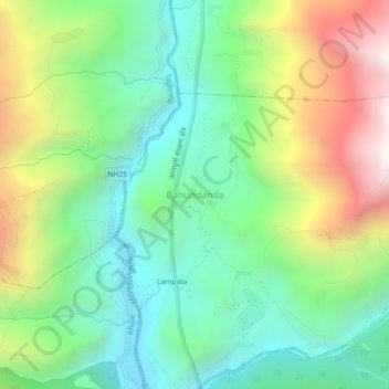
Bahundanda topographic map
Interactive map
Click on the map to display elevation.
About this map
Name: Bahundanda topographic map, elevation, terrain.
Average elevation: 1,415 m
Minimum elevation: 911 m
Maximum elevation: 2,349 m
Other topographic maps
Click on a map to view its topography, its elevation and its terrain.
Bahundanda
Népal > लमजुङ > Bahundada > Bahundanda
Bahundanda, Bahundada, Marsyangdi, लमजुङ, Gandaki, Népal
Average elevation: 1,276 m