Geolocate

Rønde topographic map

Click on the map to display elevation.

Rønde

Rønde is a hill town, with a 95-meter difference in elevation between the lowest and highest part. This kind of grade difference is unusual for Denmark, where the overall highest point in the country is 172 meters above sea level.

About this map
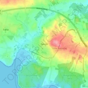
Name: Rønde topographic map, elevation, terrain.

Location: Rønde, Syddjurs Municipality, Central Denmark Region, 8410, Denmark (56.28156 10.45544 56.32156 10.49544)

Average elevation: 31 m

Minimum elevation: -2 m

Maximum elevation: 96 m

Other topographic maps

Click on a map to view its topography, its elevation and its terrain.

Gear up for your next adventure:

🛌Compact Down Sleeping Bags - Warmth without the bulk, ideal for backcountry camping
🏃Compression Recovery Socks - Reduce leg fatigue after heavy days of elevation gain
🔌Fast Charging Adapters - Quickly top up all your gear before heading back into the field
👄SPF Lip Balm - Prevent sun and wind-burnt lips on mountain ridges
🪢Paracord - Multi-purpose survival cord

As an Amazon Associate, this site earns from qualifying purchases at no extra cost to you.