
梅里雪山国家公园景区 topographic map
Interactive map
Click on the map to display elevation.
About this map
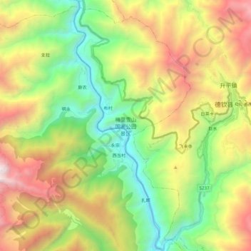
Name: 梅里雪山国家公园景区 topographic map, elevation, terrain.
Location: 梅里雪山国家公园景区, 德钦县, 迪庆藏族自治州, 云南省, 中国 (28.37495 98.79386 28.54519 98.91720)
Average elevation: 3,272 m
Minimum elevation: 1,983 m
Maximum elevation: 5,229 m
Other topographic maps
Click on a map to view its topography, its elevation and its terrain.