Geolocate

Lax topographic map

Click on the map to display elevation.

About this map

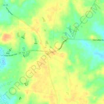
Name: Lax topographic map, elevation, terrain.

Location: Lax, Coffee County, Georgia, United States (31.45325 -83.14154 31.49325 -83.10154)

Average elevation: 85 m

Minimum elevation: 66 m

Maximum elevation: 100 m

Other topographic maps

Click on a map to view its topography, its elevation and its terrain.

Ambrose

United States > Georgia > Coffee County

Average elevation: 94 m

Gear up for your next adventure:

🥤Outdoor Water Bottles - Reusable bottles for outdoor activities
🦟Heavy Duty Insect Repellent - Essential protection against flies, mozzies, and march flies
🥾Hiking Shoes - Lightweight hiking shoes for day hikes
🧢Outdoor Sun Hats - Sun protection hats for hiking
🧦Hiking Socks - Comfortable socks for long hikes

As an Amazon Associate, this site earns from qualifying purchases at no extra cost to you.