Geolocate

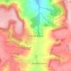
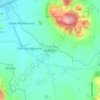
Hawling topographic map

Click on the map to display elevation.

About this map

Name: Hawling topographic map, elevation, terrain.

Location: Hawling, Tewkesbury, Gloucestershire, England, United Kingdom (51.88700 -1.92993 51.93578 -1.85362)

Average elevation: 241 m

Minimum elevation: 122 m

Maximum elevation: 300 m

Other topographic maps

Click on a map to view its topography, its elevation and its terrain.
Leigh

United Kingdom > England > Gloucestershire > Tewkesbury

Average elevation: 17 m

Alderton

United Kingdom > England > Gloucestershire > Tewkesbury

Average elevation: 68 m

Didbrook

United Kingdom > England > Gloucestershire > Tewkesbury

Average elevation: 123 m

Witcombe

United Kingdom > England > Gloucestershire > Tewkesbury

Average elevation: 140 m

Gear up for your next adventure:

💧Personal Water Filters - Drink safely from streams and lakes identified on your map
👖Convertible Hiking Trousers - Zip-off legs to adapt to changing temperatures throughout the day
🧼Clip-on Hand Sanitizer - Maintain hygiene when water for washing is scarce
🪫Rechargeable Headlamps - USB rechargeable headlamps
🎒Dry Bags - Waterproof bags for outdoor gear

As an Amazon Associate, this site earns from qualifying purchases at no extra cost to you.